[This was not written as an "Urb's Column," but we thought it belonged on the site somewhere, and there didn't seem to be any other appropriate place to put it, so there you are... ed.]
This is a recap of our motorcycle trip that encompassed May 15-23, 1998. We covered just over 2,000 miles, traveling through Illinois, Kentucky, Tennessee, North Carolina, Virginia, then back through Kentucky and Indiana before returning home.
Once you get to the bottom of Illinois,
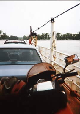
Rte. 1 reaches the Ohio River, at which point the Cave In Rock Ferry takes you
to Kentucky. Here's a sample of what the ferry ride across the Ohio looks
like (my reflection can be seen in my bike's rear-view mirror -- that wasn't
intentional):

Once we crossed the Ohio, we continued southwest, reaching Gilbertsville in an hour or so.
The LBL Rally is an annual event
put on by the Yamaha 650 Society, an organization dedicated to the care, feeding,
and preservation of Yamaha 650 twins like these:
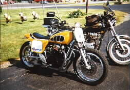
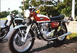
The pictures really don't do justice to these two bikes, each of which was the end result of hundreds of hours of work -- in one case, customization, and in the other, restoration. The Yamaha 650 twins have a strong following of enthusiasts; yours truly among them, although I'm not equal to the guys who put these machines together -- I just try to keep my 650 in as good running shape as possible.
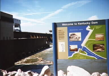
This photo shows the Kentucky Dam, on the Tennessee River. The lakes were created primarily for flood control, but they're also a recreational resource, and they generate electricity.
Along US Rte. 70, we happened upon
this unique mailbox, created by a resident of Alexandria, Tennessee:
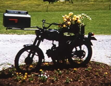
Perhaps someone with sharper eyes than mine can identify the small single-cylinder machine holding up the mailbox -- but in any case, it's one of the more creative uses for an old bike you're likely to find! [Turns out that almost five years later, on March 12, 2003, I got an e-mail from the mailbox's creator, one Gary Lawrence. Gary reports that the bike is a 1967 Honda 90 and that it's a popular local attraction. "I wish I had a dollar for everyone I've seen stop and take a picture of it," he says. "I started to throw the bike out but came up with an idea for a mailbox stand, and it has been up for 18 years." ... ed.]
They call Deal's Gap "the Dragon," and with good reason. If you're not sufficiently respectful, it'll breathe on you, as Meg found out in the first sharp left-hander. Here's her account:
Don't get me wrong. I take full responsibility for what happened next.
I went into that first turn entirely too fast and focused, instead of where I wanted the bike to go (as in, look through the turn), on directly where I thought I was going to crash and contemplated the precipice I believed before me. What I should have done will probably come more naturally to me now (counter steer and throttle, dammit) but then some memory of an out of control horse stepped in and yelled "BAIL, idiot, you know you bounce."
I'd like to tackle Rte. 129 again (actually Rte. 58 in Virginia is better), but on something a little lighter, a little zippier and a little more responsive than my "Harley knock off cruiser barge" [how 'bout an old BMW? -- ed.] but it's the only model I could flat-foot on. I remember reading an article about a year ago comparing cruisers to high heels for women: They are uncomfortable and awkward, but the general consensus is they look cool. Dunno, don't think I looked too cool when they were dusting me off!
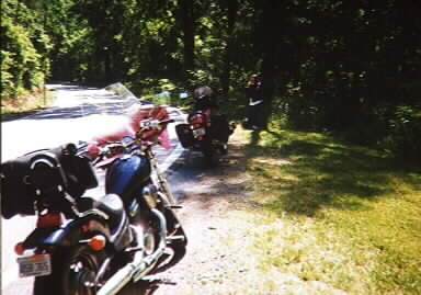
Meg's Honda Shadow may handle like a barge, but it's built like a tank. As you can see, it suffered no damage whatsoever and, like its owner, was ready to keep right on going -- I was impressed!
At the end of the Deal's Gap run, there's a store called the Crossroads of Time, which sells groceries, bike supplies, T-shirts and other memorabilia, and so forth -- they're also a gas station and bikes-only campground. Here's a shot of my bike at the Crossroads:
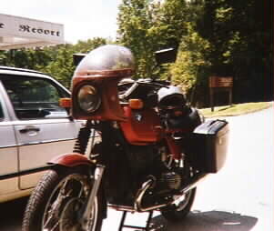
After we bought some T-shirts, duct tape, and gas at the Crossroads of Time, we continued on into western North Carolina, through Fontana village and that area. Didn't see any of the infamous Graham County cops -- I was worried about them, knowing the dim view they take of outlaw BMW riders, but apparently, Dunkin' Donuts must have been having an all-day blowout or some such thing, because there wasn't a police cruiser to be seen.
Western North Carolina has gorgeous
scenery, friendly people, and great motorcycling roads. We reached the
Blue Ridge Parkway around 2:00 in the afternoon:
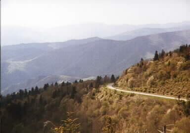
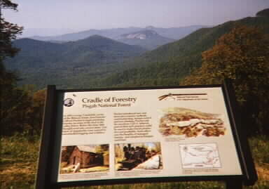
During mid-May, there was very little traffic on the Parkway, so we were able to ride at our own pace, which was pretty relaxed to begin with. Some people complain about the 45-mph speed limit on the Parkway, but they're missing the point. It's supposed to be a relaxing drive, where you're not really trying to get much of anywhere, while stopping frequently to look at the Smoky Mountains. Those who are interested in more technical riding can find it in abundance on just about any of the roads that head down into the valleys.
At the end of Day 5, we checked into a motel in Boone, NC.
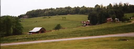
We got as far as Fancy Gap, VA, then left the Parkway and got on US Rte. 58 west. As it turned out, US 58 was a bit more involved than it appeared from the map. It changed from a 4-laner to a two-laner to an up-and-down two-laner, including some first-gear squiggles that I'm sure Meg would rather not have been subjected to. Eventually, however, it settled back down, going through the scenic Mt. Rogers National Recreation Area, and we enjoyed a pleasant afternoon's ride, ending the day in Abingdon, VA. Along the way, we passed through the town of Mouth of Wilson. I'm not making this up -- here's a shot of the post office sign:
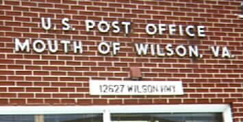
I stopped in to buy some stamps, and -- since the clerk wasn't very busy, having no other customers at the moment -- I asked where the town's name came from. He explained that an early surveying party, when the area was being mapped for the first time, had endured some harsh winter weather. One member of the surveying party, by the name of Wilson, had taken ill because of the cold, and unfortunately, his illness proved fatal. In his memory, the creek that runs behind the current post office site was named Wilson Creek. The town became known as Mouth of Wilson, because it was at the mouth of Wilson Creek (where it empties into the New River).
Interestingly enough, Abingdon, where we stopped for the night, is only about 45 miles from Boone, where we started -- we rode about 200 miles or so, but because we started out going northeast on the Blue Ridge Parkway, then turned sharply west, we ended up pretty close to where we started. No problem -- the whole idea of the trip was to see stuff, not to make time!
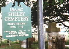
After visiting the historical park, we continued into southeastern Kentucky, finishing the day in Danville, the site of the Isaac Shelby Cemetery State Historic Site. Shelby, who played a significant role in the Revolutionary War and became the first governor of Kentucky, dangles on Meg's family tree -- she claims he was her "something-times great grandfather." We weren't able to get into the cemetery, because we arrived too late in the day. However, I did manage to snap a picture of the entry gate:
Speaking of returning home... return to kafalas.com home page